


UNION 04, Porter County, Indiana
About
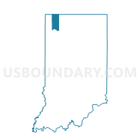
Outline

Summary
| Unique Area Identifier | 580087 |
| Name | UNION 04 |
| County | Porter County |
| State | Indiana |
| Area (square miles) | 14.07 |
| Land Area (square miles) | 14.07 |
| Water Area (square miles) | 0.00 |
| % of Land Area | 100.00 |
| % of Water Area | 0.00 |
| Latitude of the Internal Point | 41.49356900 |
| Longtitude of the Internal Point | -87.17989390 |
Maps


Graphs
Select a template below for downloading or customizing gragh for UNION 04, Porter County, Indiana


Neighbors
Neighoring Voting District (by Name) Neighboring Voting District on the Map
- CENTER 19, Porter County, IN
- CENTER 23, Porter County, IN
- HOBART CITY PRECINCT 11, Lake County, IN
- MERRILLVILLE PRECINCT 24, Lake County, IN
- PORTAGE 01, Porter County, IN
- PORTAGE 28, Porter County, IN
- PORTAGE 33, Porter County, IN
- ROSS TOWNSHIP PRECINCT 20, Lake County, IN
- UNION 01, Porter County, IN
- UNION 02, Porter County, IN
- UNION 03, Porter County, IN
- UNION 05, Porter County, IN
- UNION 06, Porter County, IN
Top 10 Neighboring County Subdivision (by Population) Neighboring County Subdivision on the Map
- Ross township, Lake County, IN (47,890)
- Portage township, Porter County, IN (47,085)
- Center township, Porter County, IN (43,267)
- Hobart township, Lake County, IN (39,417)
- Union township, Porter County, IN (8,811)
Top 10 Neighboring Place (by Population) Neighboring Place on the Map
- Merrillville town, IN (35,246)
- Hobart city, IN (29,059)
- Shorewood Forest CDP, IN (2,708)
- Wheeler CDP, IN (443)
Top 10 Neighboring Unified School District (by Population) Neighboring Unified School District on the Map
- Merrillville Community School, IN (47,642)
- Portage Township Schools, IN (47,083)
- Valparaiso Community Schools, IN (43,267)
- Hobart School City, IN (23,679)
- Union Township School Corporation, IN (8,811)
Top 10 Neighboring State Legislative District Lower Chamber (by Population) Neighboring State Legislative District Lower Chamber on the Map
- State House District 4, IN (74,588)
- State House District 19, IN (72,438)
- State House District 13, IN (70,000)
- State House District 10, IN (68,806)
Top 10 Neighboring State Legislative District Upper Chamber (by Population) Neighboring State Legislative District Upper Chamber on the Map
Top 10 Neighboring 111th Congressional District (by Population) Neighboring 111th Congressional District on the Map
Top 10 Neighboring Census Tract (by Population) Neighboring Census Tract on the Map
- Census Tract 506.04, Porter County, IN (8,091)
- Census Tract 423, Lake County, IN (7,248)
- Census Tract 420, Lake County, IN (6,568)
- Census Tract 505.09, Porter County, IN (4,803)
- Census Tract 510.05, Porter County, IN (4,425)
- Census Tract 510.06, Porter County, IN (4,417)
- Census Tract 505.05, Porter County, IN (2,469)